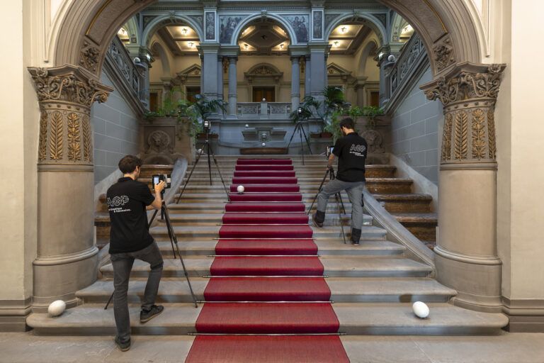
Architectural surveys
Several digital methods are used for architectural survey and data acquisition. Each monument, each part of a building, each decorative element, has unique characteristics and is in particular conditions . All the techniques used for each project are defined by AGP, based on these singularities. The surveys are essential for any work of study, for the establishment of archives and for all restoration works (see video).
AGP statements are made by engineers and land surveyors specialized in the historical heritage field and are operated by all stakeholders of cultural heritage: architects, institutions, local authorities, cultural organizations, businesses and individuals.
Point cloud
The point cloud is the first three-dimensional result obtained from a laser survey and constitutes an impressive tool for the 3D handling and viewing of a structure. The plots can contain billions of points and enable a survey accuracy of up to 1 mm, thus surpassing surveys performed in a more conventional manner.
As experts in the field of surveying, the AGP teams create their point clouds using high-end laser-scanner technology, combining performance, accuracy and rapidity. The virtual model created from this database provides the commissioner with all of the building’s dimensions, whether linear, surface or indeed volume measurements. It is also possible to create a video film from the point cloud.
Ortho-images and Ortho-photographs
The ortho-image is a digital image from the orthographic projection of a three-dimensional information.This information is most often a point cloud acquired by laser scanning or dense photogrammetric correlation. The orthoimage offers the advantage of being a metric document independent of the perspective whose accuracy is maintained regardless of the morphology of the area (unlike the rectified photo which has no metric value except for the study of a plane object)
Generating an ortho-image from a high-resolution colorfull camerawork allows the generation of a metric orthophotograph that combines precision and textural richness of photography.
Like orthoimages, orthophotographs enable a built element to be orthometrically measured. They are obtained after performing digital processing on a multitude of shots projected onto a geometry resulting from their own point cloud, calculated or taken from a lasergrammetric survey so that each point or pixel can be superimposed onto its corresponding map. The orthophoto adds a colorimetric and radiometric value calibrated on the orthoimage.
The shots performed by AGP are of a very high definition and result from professional digital cameras calibrated in order to obtain a high-quality, precise, orthorectified photograph.
Detailed surveys
The detailed surveys performed by photogrammetry and/or lasergrammetry enable an accurate representation to be obtained of a specific element of a structure or of an architectural décor. They are of use when it is necessary to have a highly accurate representation for a study or in order to constitute archives for preventive conservation.
Art Graphique & Patrimoine’s experts, specialists in heritage restoration, stonecutters and art historians, offer reconstructions combining precision and historical accuracy for renderings of remarkable quality.
Representation levels
According to the study and the degree of precision sought, several levels of rendering can be offered by our 2D hub.
1/200 and 1/100 outputs: For rapid viewing of the proportions, a simple representation with primary architectural lines.
1/100 outputs: For a stability study, a sanitary status report, with more precise viewing of the secondary architectural elements.
1/50 outputs: For a more precise sanitary status report (more in-depth location of disorders), a complete representation of the architectural elements and alterations visible on this scale.
1/20 and 1/10 outputs: For a close study with a detailed representation of the sculpture, ornamentation, mouldings and alterations.
General surveys
The laser-scanner surveys can be performed to get a complete representation of the structure or parts of the structure and enable two-dimensional renderings. From the point cloud it is possible to extract plans, sections and elevations at the desired scale, the database obtained from the point cloud offers accuracy ranging from 1mm to 15m, according to the needs and indications of the principal contractor.
The AGP teams, composed of drafters with proven expertise, are the guarantee of accurate, faithful representations, whilst remaining attentive to customer requests.
Deformation maps
Deformation maps enable the deformations, slants, subsidence, cracks on parts of a building to be observed. They constitute an indispensable tool in understanding and analysing the nature of the damage on a structure. After digitisation of the studied surface it is possible to compare the map obtained with a relative section. The coloured zones represent the altimetric variations with respect to the relative map (switching from red/projection to blue/hollow, with green the map’s reference colour).
Developments
AGP produces developments of simple surfaces but also offers developments of domes, cul-de-four vaults and spherical surfaces. This flattening is performed by specific programmes developed in-house. Complex developments are conducted by Albers conic projections to avoid seams and connections liable to hinder restorers from locating pathologies. The craft of the Art Graphique & Patrimoine’s teams enables us to represent the most complex of geometric forms, even combined.